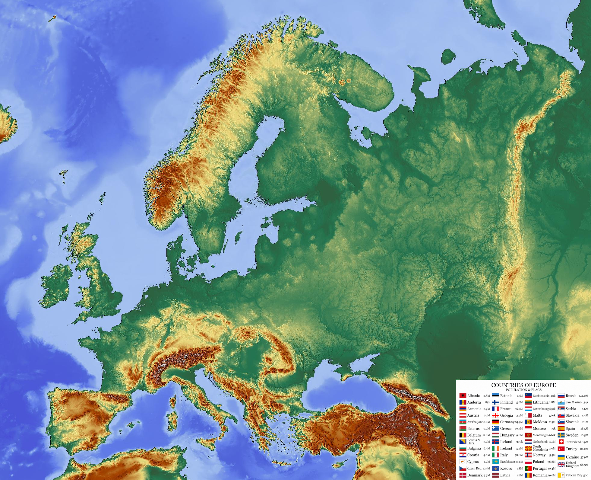
Physical Map of Europe
Europe is the second-smallest continent by surface area, yet it has played a predominant role in global history, culture, philosophy, science, and economic development. Bordered by the Arctic Ocean to the north, the Atlantic Ocean to the west, the Mediterranean Sea to the south, and Asia to the east, Europe is widely regarded as the birthplace of Western civilization, modern democracy, and the Industrial Revolution.
Geographically, Europe is a large peninsula of Eurasia characterized by deeply indented coastlines, major peninsulas—such as the Scandinavian, Iberian, Italian, and Balkan peninsulas—and thousands of islands, including Great Britain, Ireland, Iceland, Sicily, Sardinia, and Crete. Major cultural and economic hubs like London, Paris, Berlin, Madrid, Rome, Vienna, and Warsaw attract millions of visitors annually for their architecture, museums, and historical landmarks.
Most of Europe enjoys a temperate climate, heavily moderated by the Gulf Stream, ranging from oceanic and continental climates in the west and center to subarctic conditions in the far north and a warm Mediterranean climate along its southern coasts. Economically, Europe is one of the wealthiest regions in the world, featuring highly integrated markets (led by the European Union), advanced manufacturing, financial services, technology, tourism, and productive agriculture.
Europe - Statistical Data (UN & Regional Overview)
Geography & Population
- Population: 745,000,000
- Surface Area: 10,180,000 km²
- Pop. Density: 73.2 / km²
- Forested Area: 46.0% of land
Economy & GDP
- GDP (Gross Domestic Product): $25,500,000,000,000
- GDP Growth Rate (Annual): 1.5%
- GDP Per Capita: $34,200
- Primary Bloc: European Union
- Main Currency: Euro (€)
Employment by Sector
- Services Sector: 70.5%
- Industry Sector: 24.5%
- Agriculture Sector: 5.0%