
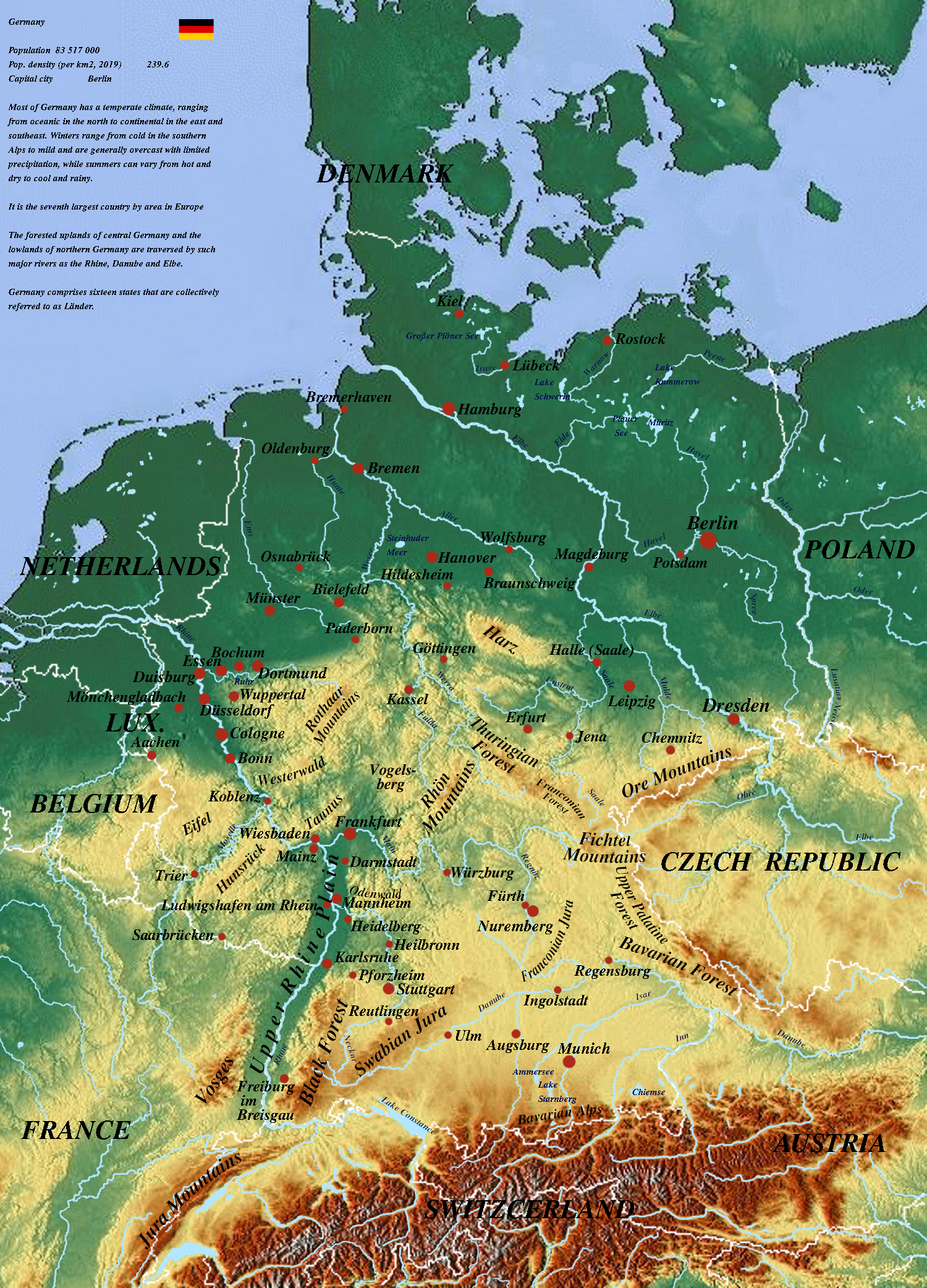
Physical Map of Germany
Germany is located in west-central Europe, stretching from the dramatic peaks of the Alps in the south, across the forested Central Uplands, to the low-lying terrain of the North European Plain bordering the North Sea and the Baltic Sea. The country features a generally moderate maritime climate with warm summers and mild, cloudy winters, transitioning to a more continental climate further south and east.
As one of the world's leading industrial powerhouses, the German economy relies heavily on its automotive, engineering, chemical, and technology sectors. In addition to industry, Germany maintains a highly efficient agricultural sector, producing significant quantities of wheat, barley, poultry, dairy, and pork products.
Germany is distinguished by its exceptionally high standard of living, very low level of poverty, and strong public infrastructure. Its world-class social security network provides universal health care, comprehensive pensions, an advanced public transport system, and a tuition-free higher education system.
Germany - Statistical Data (UN Data 2018)
Geography & Population
- Population: 82,792,350
- Surface Area: 357,588 km²
- Pop. Density: 231.5 / km²
- Urban Population: 77.3%
- Forested Area: 32% of land
Economy & GDP
- GDP (Gross Domestic Product): $3,949,540,000,000
- GDP Growth Rate (Annual): 1.5%
- GDP Per Capita: $47,603
- International Trade (Exports): $1,556,740,000,000
- International Trade (Imports): $1,286,220,000,000
Employment by Sector
- Services Sector: 74.5%
- Industry Sector: 24.2%
- Agriculture Sector: 1.3%